Live Amphibious Command Ship Tracker / Real-Time Tracking of Amphibious Command Ships
Track A Military Amphibious Command Ship
There are currently 2 Military Amphibious Command Ships available for tracking below. Select a specific amphibious command ship to view its most recent reported position on an interactive map, along with other nearby live ship traffic. Additional detailed voyage information, including the ship's real-time location, route, speed, course history, itinerary updates, port destinations, estimated arrival times, and more, may also be available. All ship position data is sourced directly from the global AIS tracking system, ensuring accurate and up-to-date information.
Amphibious command ships are naval vessels that serve as command centers during amphibious operations, providing advanced communication, coordination, and control facilities for naval and ground forces. These ships are crucial for leading large-scale operations and often serve as the flagship of amphibious task forces, facilitating strategic decision-making during complex missions.
Locate and track a specific Military Amphibious Command Ship by selecting it from the ship tracking options available below.
United States Navy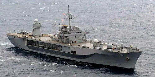
USS Blue Ridge
Amphibious Command Ship
Blue Ridge - Class
In Service: 1970
United States Navy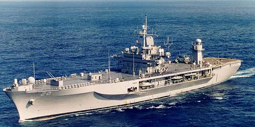
USS Mount Whitney
Amphibious Command Ship
Blue Ridge - Class
In Service: 1971
Track Cruise Ships, Cruise Ferries, Research Ships, Military Ships and Famous Ships right here live on Cruising Earth!
Get the latest current and forecast weather information that may affect your cruise vacation travel plans.
Live Weather Radar Hurricane Tracker Hurricane Reconnaissance Tropical Weather Events Satellite Imagery Port Weather Weather Links