Tropical Weather Events - Cruising Earth
Tropical Weather Events
Cruising Earth tracks tropical weather events using official storm data and live cameras along the storms path. Track and view the impact of these tropical weather events both active and past. Select a storm link below to view detailed storm data, landfall information, and live storm cameras if available.
Active Tropical Weather Events
Selecting an active storm below will provide the latest complete storm data, a projected landfall map, and a satellite imagery loop of the storm.

Cruising Earth is not currently tracking any active tropical weather events.
If you believe there is an active tropical event we should be tracking please report it: Contact Us
Past Tropical Weather Events
The storm categories and maximum winds shown below represent the highest intensity each past storm reached during its lifetime. Selecting a past storm will provide its landfall data, a map of the landfall location, and, if available, historical satellite imagery at landfall. If a storm made multiple landfalls, the data and map for the final landfall will be displayed.
- Tropical Storm Sara
(2024)
Tropical Basin: Atlantic
Historical Max Winds:
50 MPH (TS) - Category 3 Hurricane Rafael
(2024)
Tropical Basin: Atlantic
Historical Max Winds:
120 MPH (Cat 3) - Tropical Storm Patty
(2024)
Tropical Basin: Atlantic
Historical Max Winds:
65 MPH (TS) - Category 1 Hurricane Oscar
(2024)
Tropical Basin: Atlantic
Historical Max Winds:
85 MPH (Cat 1) - Tropical Storm Nadine
(2024)
Tropical Basin: Atlantic
Historical Max Winds:
60 MPH (TS) - Category 5 Hurricane Milton
(2024)
Tropical Basin: Atlantic
Historical Max Winds:
180 MPH (Cat 5) - Category 2 Hurricane Leslie
(2024)
Tropical Basin: Atlantic
Historical Max Winds:
105 MPH (Cat 2) - Category 4 Hurricane Kirk
(2024)
Tropical Basin: Atlantic
Historical Max Winds:
145 MPH (Cat 4) - Tropical Storm Joyce
(2024)
Tropical Basin: Atlantic
Historical Max Winds:
50 MPH (TS) - Category 2 Hurricane Isaac
(2024)
Tropical Basin: Atlantic
Historical Max Winds:
105 MPH (Cat 2) - Category 4 Hurricane Helene
(2024)
Tropical Basin: Atlantic
Historical Max Winds:
140 MPH (Cat 4) - Tropical Storm Gordon
(2024)
Tropical Basin: Atlantic
Historical Max Winds:
45 MPH (TS) - Category 2 Hurricane Francine
(2024)
Tropical Basin: Atlantic
Historical Max Winds:
100 MPH (Cat 2) - Category 2 Hurricane Ernesto
(2024)
Tropical Basin: Atlantic
Historical Max Winds:
100 MPH (Cat 2) - Category 1 Hurricane Debby
(2024)
Tropical Basin: Atlantic
Historical Max Winds:
80 MPH (Cat 1) - Tropical Storm Chris
(2024)
Tropical Basin: Atlantic
Historical Max Winds:
40 MPH (TS) - Category 5 Hurricane Beryl
(2024)
Tropical Basin: Atlantic
Historical Max Winds:
165 MPH (Cat 5) - Tropical Storm Alberto
(2024)
Tropical Basin: Atlantic
Historical Max Winds:
50 MPH (TS) - Category 5 Hurricane Otis
(2023)
Tropical Basin: Eastern Pacific
Historical Max Winds:
165 MPH (Cat 5) - Category 5 Hurricane Lee
(2023)
Tropical Basin: Atlantic
Historical Max Winds:
165 MPH (Cat 5) - Category 3 Hurricane Idalia
(2023)
Tropical Basin: Atlantic
Historical Max Winds:
125 MPH (Cat 3) - Tropical Storm Franklin
(2023)
Tropical Basin: Atlantic
Historical Max Winds:
50 MPH (TS) - Category 1 Hurricane Nicole
(2022)
Tropical Basin: Atlantic
Historical Max Winds:
75 MPH (Cat 1) - Category 4 Hurricane Ian
(2022)
Tropical Basin: Atlantic
Historical Max Winds:
155 MPH (Cat 4) - Category 1 Hurricane Nicholas
(2021)
Tropical Basin: Atlantic
Historical Max Winds:
75 MPH (Cat 1) - Category 4 Hurricane Ida
(2021)
Tropical Basin: Atlantic
Historical Max Winds:
150 MPH (Cat 4) - Category 1 Hurricane Henri
(2021)
Tropical Basin: Atlantic
Historical Max Winds:
75 MPH (Cat 1) - Category 3 Hurricane Grace
(2021)
Tropical Basin: Atlantic
Historical Max Winds:
125 MPH (Cat 3) - Tropical Storm Fred
(2021)
Tropical Basin: Atlantic
Historical Max Winds:
65 MPH (TS) - Category 1 Hurricane Elsa
(2021)
Tropical Basin: Atlantic
Historical Max Winds:
85 MPH (Cat 1) - Tropical Storm Danny
(2021)
Tropical Basin: Atlantic
Historical Max Winds:
40 MPH (TS) - Category 2 Hurricane Zeta
(2020)
Tropical Basin: Atlantic
Historical Max Winds:
110 MPH (Cat 2) - Category 2 Hurricane Sally
(2020)
Tropical Basin: Atlantic
Historical Max Winds:
105 MPH (Cat 2) - Category 4 Hurricane Laura
(2020)
Tropical Basin: Atlantic
Historical Max Winds:
150 MPH (Cat 4) - Tropical Storm Eta
(2020)
Tropical Basin: Atlantic
Historical Max Winds:
65 MPH (TS) - Category 4 Hurricane Delta
(2020)
Tropical Basin: Atlantic
Historical Max Winds:
145 MPH (Cat 4) - Tropical Storm Beta
(2020)
Tropical Basin: Atlantic
Historical Max Winds:
60 MPH (TS)
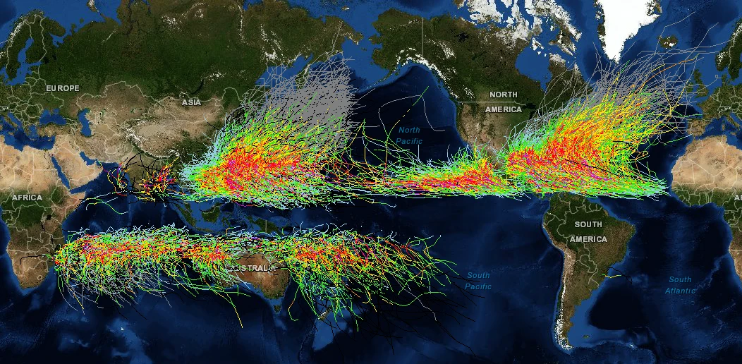
Historical Storm Tracks
Cruising Earth is not an official source for severe weather information. Please refer to your region's official weather service as your primary source for severe weather updates and decision-making to keep you and your family safe.
Check directly with your cruise line for any possible weather related delays or itinerary changes. Many cruise lines will also allow you to sign-up online to receive weather alerts via email or text message pertaining to your specific cruise.